 Loading... Please wait...
Store Navigation
- Home
- Archival prints
- Oost-Indische Pas-Caart 1633
Product Description
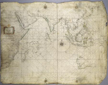
Copper engraving on vellum. One of four copies extant. This chart of the Indian Ocean incorporates the Dutch discoveries in Australia based on Hessel Geritsz' Chart of the Malay Archipelago [1628]. Scale computed from one degree latitude measuring 7,6 mm. This large map carries five wind-roses and two graphic scales: 20 English and French miles or 15 German miles to a degree. Approximate image size 93 x 72 cm


