 Loading... Please wait...
Store Navigation
- Home
- Archival prints
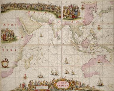
- Oost Indien wassende-graade paskaart, vertoonende nevens het Oostelyckste van Africa, meede de zeekusten van Asia, van C. de Bona Esperanca tot Eso, b
Product Description
A most embellished map of the East Indies. First fashioned by Goos after Doncker's t'Ooster deel van Oost Indien (1660), this edition was published by Keulen after 1680 and before his retirement in 1704. Tony Campbell (Early maps, 1981) considers Goos' original as probably datable to 1658, "the first newly engraved map to name all the Dutch discoveries in Australia".

