 Loading... Please wait...
Store Navigation
- Home
- Archival prints
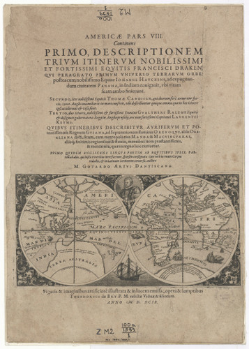
- Map of the world showing Drake's voyage. Frontispiece from America, part VIII, c.1599
Product Description
The first of De Bry's maps, the frontispiece of his America, part VIII [Americæ, pars VIII], is the largest and finest. It is an expertly-engraved reduction of Jodocus Hondius' celebrated broadside map of c1595 showing Drake's circumnavigation. Has portrait of Francis Drake taken from broadside text often mounted around Hondius' map.
Double hemispherical map of the world showing Drake's route taken when circumnavigating the world set on page of Latin text only.
Extracted title page from: Theodor de Bry's, Americæ, pars VIII.
Shows "Nova Guinea" separated from "Terra Australis" and an unnamed promontory but resembling "Beach".


