Loading... Please wait...

Store Navigation
- Home
- Archival prints
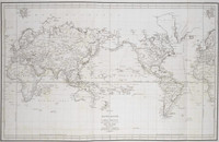
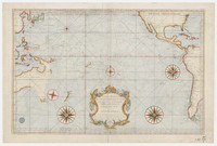
- Carte reduite du Grand Ocean compris entre l'Asie et l'Amerique, 1797


Product Description
Map of Oceania and many of its islands featuring Nouvelle Zealand [i.e. New Zealand]; Nouvelle Holland [i.e. Australia], Amerique Septentrionale and Amerique Meridionale [i.e. North and South America]. Relief is shown pictorially.
Prime meridian: Paris.
Probably listed in: Catalogue des cartes, plans et vues de cotes qui composent l'Hydrographie Francaise. Paris : Dezauche, 1832.