Loading... Please wait...

Store Navigation
- Home
- Archival prints
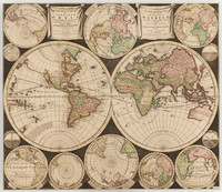
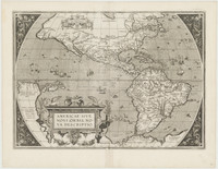
- Planisphærium terrestre cum utroque coelesti hemisphærio, sive diversa orbis terraquei 1700


Product Description
Double hemispherical world map showing routes of explorers including Magellan, Dampier, Tasman and Chaumont. Relief shown pictorially. In Latin. Probably from: Atlas contractus sive mapparum geographicarum. Amstelæaedami : P. Schenk, [1700?] Prime meridian: Ferro. Includes twenty-six smaller astronomical diagrams and hemispheres of the world, two larger celestial hemispheres and textual commentary. Nova Guinea separated from Carpentaria; thus one of the first maps showing the Torres strait.