Loading... Please wait...

Store Navigation
- Home
- Archival prints
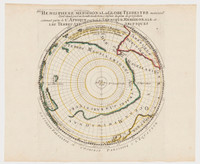
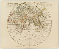
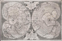
- Untitled world map on a double hemisphere polar projection with each hemisphere drawn onto 36 gores


Product Description
World map after Mercator's 1538 double cordiform map and included in many Lafreri-type Italian atlases of the 1560s. Main meridian Ferro. Antonio Floriano's map is dated by Nordenskioeld as before 1566, because it does not include the Anian Strait then first shown on maps by Zaltieri. (Fretum Anian was the much sought North-West Passage to China .) This fine copperplate map could make a globe of 25,7 cm. diameter and remains unfinished, with blank title panels and lower cartouches.